Click to zoom photo

Highlights I wanted to share, 

    the next stories, those I want to tell

Chris Claremont, a Brit by birth, is an American comic book writer and novelist, who worked for Marvel Comics. He once wrote, “The more stories I told, the more I found I wanted to tell. There was always something left unsaid. I got hooked by my own impulse of 'Well, what's gonna happen next?’”


That’s the way I feel about highlighting stuff about Wisconsin for you that cannot be left unsaid.


Claremont expresses my feeling perfectly: “What excites me, what attracts me, what gets me up in the morning is telling the next story and getting it out in front of readers and hoping they'll love it too.”


 There is no end to the stories I could tell. I hope you enjoy these.

The Niagara Escarpment

An escarpment is a long, steep slope, especially at the edge of a plateau or separating acres of land at different heights.  and it travels some 650 miles from Niagara Falls, New York in a semi circle westward through eastern Wisconsin. It runs predominantly east/west from New York State, through Ontario, Michigan, ending in Wisconsin**. The escarpment is most famous as the cliff over which the Niagara River plunges at Niagara Falls, for which it is named.

The Niagara Escarpment consists of a gently sloping layer of rock forming a ridge. One side of the ridge has a gentle slope, a so-called dip slope that is essentially the surface of the rock layer. The other side is a steep bluff.


Fundamentally, the escarpment was formed over millions of years of erosion of rocks of different hardnesses. The “caprock” is dolomitic limestone. It is more resistant and sits atop weaker, more easily eroded shale. 


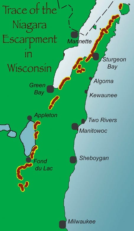
In Wisconsin, the escapement is often called “The Ledge.” It extends about 250 miles within the state. There are several notable areas where you can easily view the escarpment. 


Ro Stieglitz, writing for “Geoscience” Wisconsin, noted, 


“Several state, county, and town parks are located on or adjacent to the escarpment, from Rock Island State Park in the north to at least Ledge County Park in Dodge County to the south.”

Looking at this graphic, you can conclude that the Niagara Escarpment travels through the Eastern Ridges and Lowlands Geographic Province of Wisconsin. The Eastern Ridges and Lowlands region is primarily a plain with elevations between 700 and 900 feet above sea level, with some elevations that exceed 1,000 feet above sea level.


Door County


For all the time I have driven through Door County, I did not realize that the escarpment ran through the west side of Door County.  This is a good lesson to study some things to see and know before traveling!


Before his death, Robert Schrock, a highly respected geologist at MIT,  Wrote “Geology of Washington Island.:” In an excerpt, he provided an excellent description of the escarpment relevant to Door County:


“One of the most spectacular surface features in eastern Wisconsin is the Niagara Escarpment or ‘The Ledge’ as it is called locally. It is a steep, westward-facing cliff that rises out of the glacial drift a few miles south of Waukesha (located just west of Milwaukee) and increases in height northward until it stands over 100 feet above the northern end of Lake Winnebago at High Cliff (southwest of Green Bay). 


“It then dies out for a short distance, but soon appears as a low bluff east of Green Bay, and clinging to the eastern shores of the bay, it increases steadily in height until it culminates in the bold, precipitous cliffs at Eagle Point Park near Ephraim and at Ellison Bay near the northern end of the (Door) peninsula. At their greatest height, the cliffs rise over 150 feet above the waters on Green Bay.


“Northward from the tip of Door Peninsula, the escarpment base becomes submerged beneath at least 140 feet of water; yet because of increased height, it still rises well over 140 feet above water in Boyer Bluff, at the northwestern tip of Washington Island, and in the precipitous, triple-notched cliff at Pottawatomi Park, Rock Island.”


The Door County Coastal Byway website tells us this:


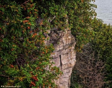
“Door County’s Green Bay side has the true escarpment with exposed dolomite rock 200-250 feet high. At the base of these rock faces are remnants of the chunks of stone that fall from the cliffs to form ‘talus.’ Some of the oldest living trees in the Midwest, some almost 1200 years old, are found on the Escarpment. These trees are deformed, barely alive, white cedars found on the rock cliffs. Interestingly, the same tree growing in optimum conditions lives only 1/3 as long as the ‘cliffhangers.’


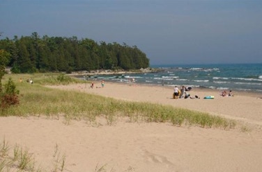
“In Door County, the landscape slopes downward to the Lake Michigan side in what is known as a ‘cuesta,’ or a ‘dip slope plain’ in geology speak. Generally, on the Lake side, there are sand beaches and shallow inland lakes that are the remnants of glacial bays that have filled in over time. “


Rock Island - Door County


In Wisconsin, the escarpment begins on Rock Island.  About four miles to the northeast lies St. Martin Island, Michigan. St. Martin is one of seven islands from the Garden Peninsula of Michigan.


These islands in Michigan and Wisconsin, and several others in Wisconsin I will mention in a moment, form a group of islands collectively referred to as the Potawatomi Islands. They extend across Lake Michigan between the Door Peninsula and the Garden Peninsula of Michigan to the northeast.  


Rock Island is the northernmost island of the Wisconsin part of that chain.  These islands and others I will mention shortly are part of the Niagara Escarpment.


The Google Earth blowup of Rock Island shows the ledges on the west and northern side.


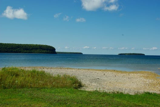
Gary Jean took this photo from  Washington Island to Rock Island during a kayak paddle. The escarpment here on Rock Island is prominent. I commend a video of the kayak journey. 


Washington Island - Door County


Washington Island lies just a mile to the southwest of Rock Island. It, along with Hog and Fish Islands lying to the east and Detroit, Plum, and Pilot Islands lying to the south, are all part of the Potawatomi Chain. 


Returning to Dr Schrock, recall he wrote:


“Northward from the tip of Door Peninsula, the escarpment base becomes submerged beneath at least 140 feet of water; yet because of increased height, it still rises well over 140 feet above water in Boyer Bluff, at the northwestern tip of Washington Island, 


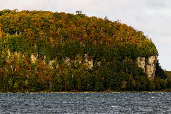
The photo to the left is of Boyer Bluff, photographed by Irene Kuiper.


The photo to the right is part of the Jackson Harbor on Washington Island. 


Both of these photos require you to be in a boat. I’ll note here that much of the area of Jackson Harbor is known as the Jackson Harbor Ridges. The Ridges are a Wisconsin Scientific Area marked by dunes and swales. A swale is a low or hollow place, especially a marshy depression between ridges.


Ellison Bay - Door County


As you “round the corner” from Door Peninsula’s northern tip and head to the southwest, you come across Ellison Bay.  Shortly after driving through this beautiful town, you come across Ellison Bluff State Natural Area, noted by the green arrow.


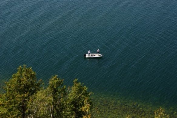
This is a 174-acre park that offers a fabulous view of the Green Bay. A wooden walkway-boardwalk takes you to the edge of the sheer, 100-foot limestone bluffs of the escarpment. 


And then I looked down and saw two people fishing.


The boaters likely saw this from where they were or something like it.  Recall I reported earlier that there are a lot of trees on this portion of the escarpment, some of the oldest in the Midwest.


Ephraim - Door County


To the southwest of Ellison Bay is Ephraim. The town sits on a small bay off of the Green Bay.  The green arrow points to Peninsula State Park. Once again, you can see the shadow of the escarpment running along the north and west of the park.


While on Water Street in the heart of town, I caught a glimpse across the small bay. To the left is Peninsula State Park. You can see the escarpment. To the far right center, you can see an island called Horseshoe Island. It is a small island, about 38 acres, but it was a home and fishing site for Native Americans over 2,500 years ago. Many people today kayak or boat and enjoy the trails, fishing, and wildlife viewing.


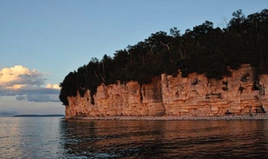
I want to show you a glimpse of part of the escarpment in the park. Again, from the water. Hopefully, you kayakers have seen by now the tremendous adventure you could have by paddling along the escarpment of Door County.


Brown County - Wequiock Falls


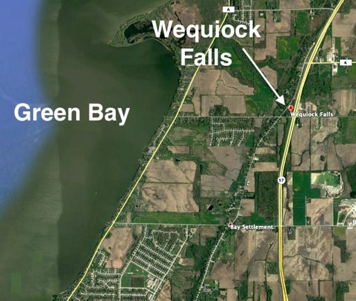
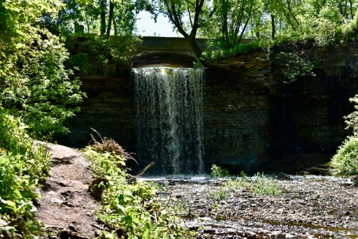
Wequiock Falls is about six miles northeast of Green Bay City. It is part of the Niagara Escarpment, as small as it is. 


Wequiock Creek is a relatively small watershed. The creek meanders through flatlands before feeding the falls. It then goes on to contribute nutrients and sediment to the Green Bay. 


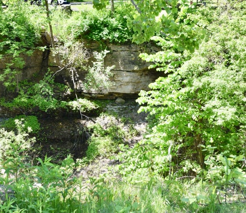
The falls are Niagara Dolomite with Maquoketa Shale underneath. The water drips under the cap and erodes the soft shale. It has cut a little glen.


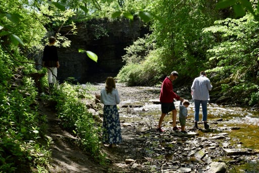
Get down in there and walk around!


Brown County - Green Bay Region


The escarpment skirts to the east of Green Bay city.  The escarpment travels to the northeast side of the city. It is then covered with glacial till for several miles, reappearing in the region between Ledgeview (red dot) and Morrison (green dot), marked roughly by the white arrows, after which it is again covered by glacial till. 


If you take CR PP to the south out of De Pere and then get on CR W to the southeast and east, you will cross over the escarpment. Most people doing this probably do not know that they have done that!


Brown County - Ledgestone Winery Area


This may surprise you. It surprised me.  I’ll introduce you to LedgeStone Vineyards and the nearby area. First, the vineyard. It is over a mile north of Greenleaf, WI, on Hwy 32-57. and about 12 miles south-southwest of Green Bay City.


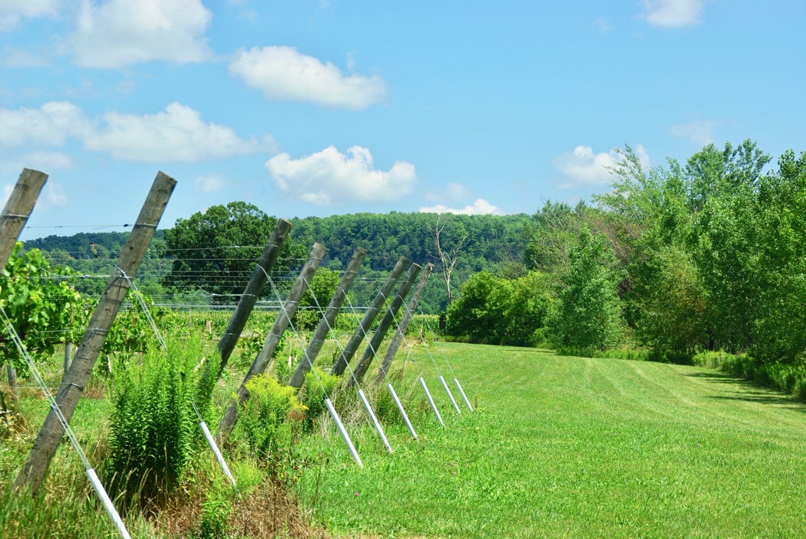
LedgeStone is at the foot of the Niagara Escarpment. This is a look at part of the escarpment nearby.


You can see the escarpment in the background. I took this photo in April. 


Here, you can see the grape vines with the escarpment in the background. I took this photo in April. 


The LedgeStone Vineyards describes the advantages of the Escarpment this way:


“The escarpment can be compared to a large cereal bowl where the edge of the bowl is the escarpment.  It is a pre-glacial formation that existed when this area was covered with ocean water.


“The glaciers etched back the edges of the escarpment in Northeastern Wisconsin, exposing the beautiful formations that can be observed here in Greenleaf and in other areas such as High Cliff State Park just southwest of here. “


High Cliff State Park - Calumet County


High Cliff State Park is on the northeastern edge of Lake Winnebago in Calumet County and about 12 miles the way the crow flies southwest of LedgeStone Vineyard. It is near Sherwood, Wisconsin. It gets its name from the limestone cliffs of the Niagara Escarpment.


This park is the only state park on Lake Winnebago, about 1,187 acres. It is a beautiful park with lots of trails, campgrounds, Indian mounds, a general store, even a marina, and, of course, plenty of limestone rock.


It’s not the easiest park to find. I was surprised to have driven through several residential areas on my way into the park. 


You’ll see the escarpment as soon as you drive into the park area. 


There are trails in the rock formations. I chose not to take those because of time limits, but I did look in there and saw many people on the trails below. Here are a few photos of what I saw.


This is a fun park to explore the rock formations and get right down in there!


Oakfield Ledge State Natural Area - 

Fond du Lac County


The Niagara Escarpment hugs the eastern edge of the Horicon Marsh, about 16 miles southwest of Fond du Lac. It has been formally recognized as a Wetland of International  Importance. It is one of the most extensive intact freshwater wetlands in the US.  


Both the Niagara Escarpment and Horicon Marsh were formed by the Green Bay Lobe of the Wisconsin glacier. This lobe also carved out the Green Bay, the Lake Winnebago Basin, and Lake Michigan.


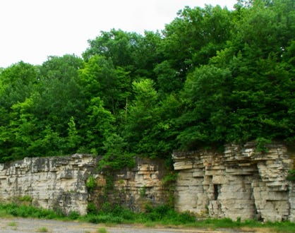
The escarpment is well-exposed in this section of Fond du Lac County and at places such as High Cliff Park in Calumet County, discussed earlier.  This is a remarkable geologic region of the state.


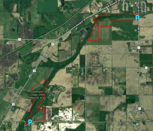
Oakfield Ledge State Natural Area is divided into two parts, north and south. I visited the south. It was not easy to find. I first went to the town of Oakfield, about 8-10 miles southwest of Fond du Lac. Once in the town, head south on Main St. and take a right onto CH B. Bear left on CH B, where it meets CH D. 


Keep your eyes open to the left, looking for a small gravel parking area marked Oakfield State Natural Area. 


Park there and take the trail for a short bit into the tree line! You are there. Now explore.


I have to say I had a lot of fun here. I do wish to caution you to be careful when you visit. You will be lured to get as close to some of these formations as possible and even climb in!


This website makes use of cookies. Please see our privacy policy for details.

Deny

OK